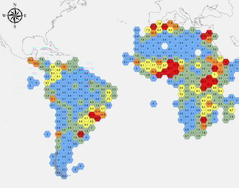
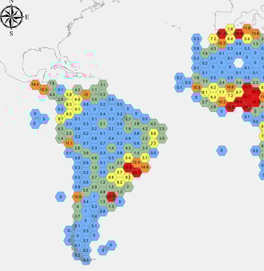
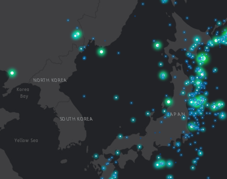
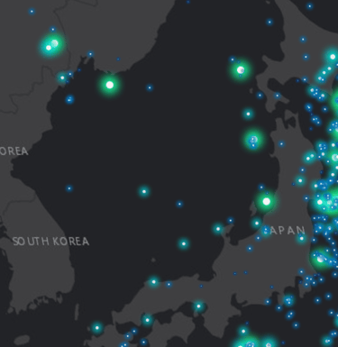
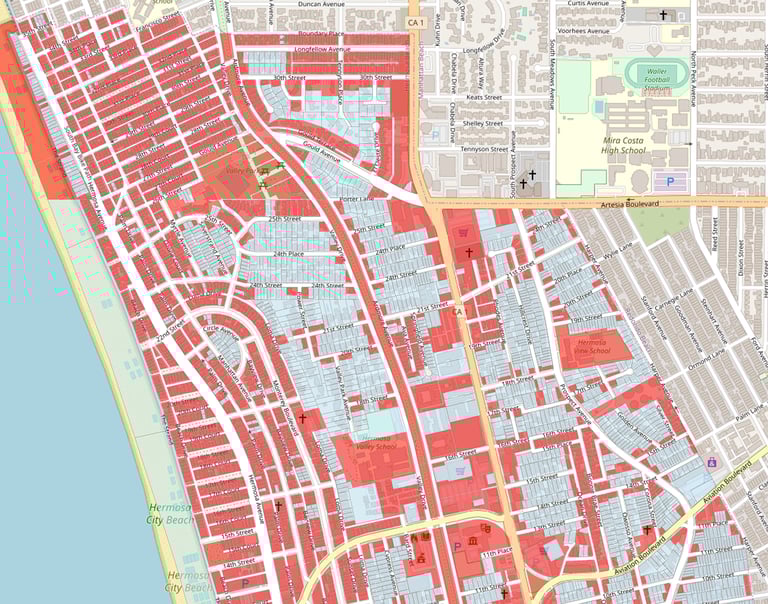
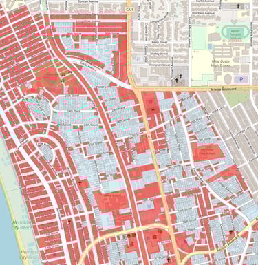
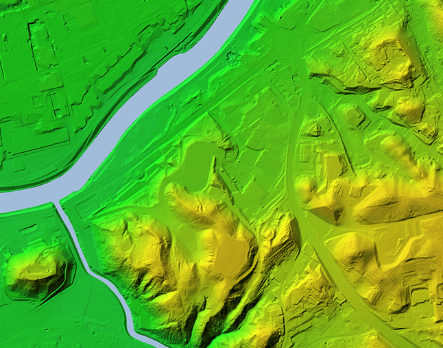
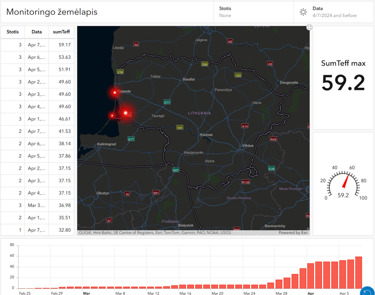
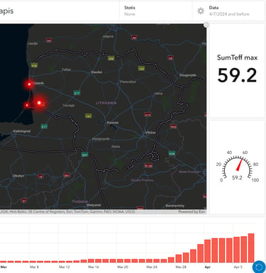
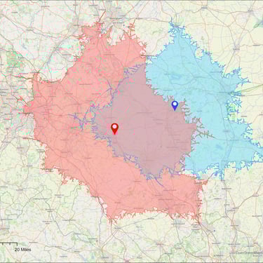
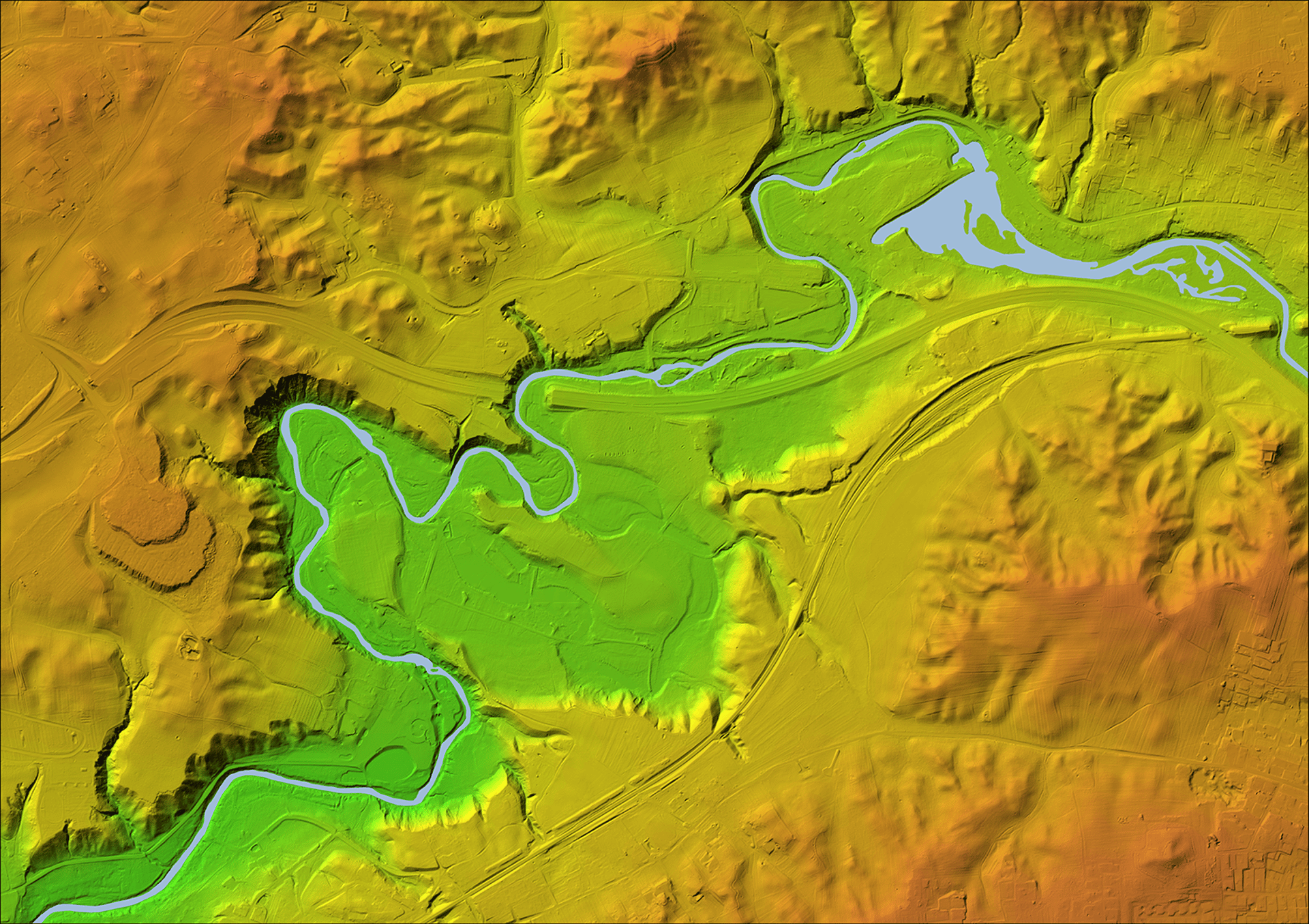
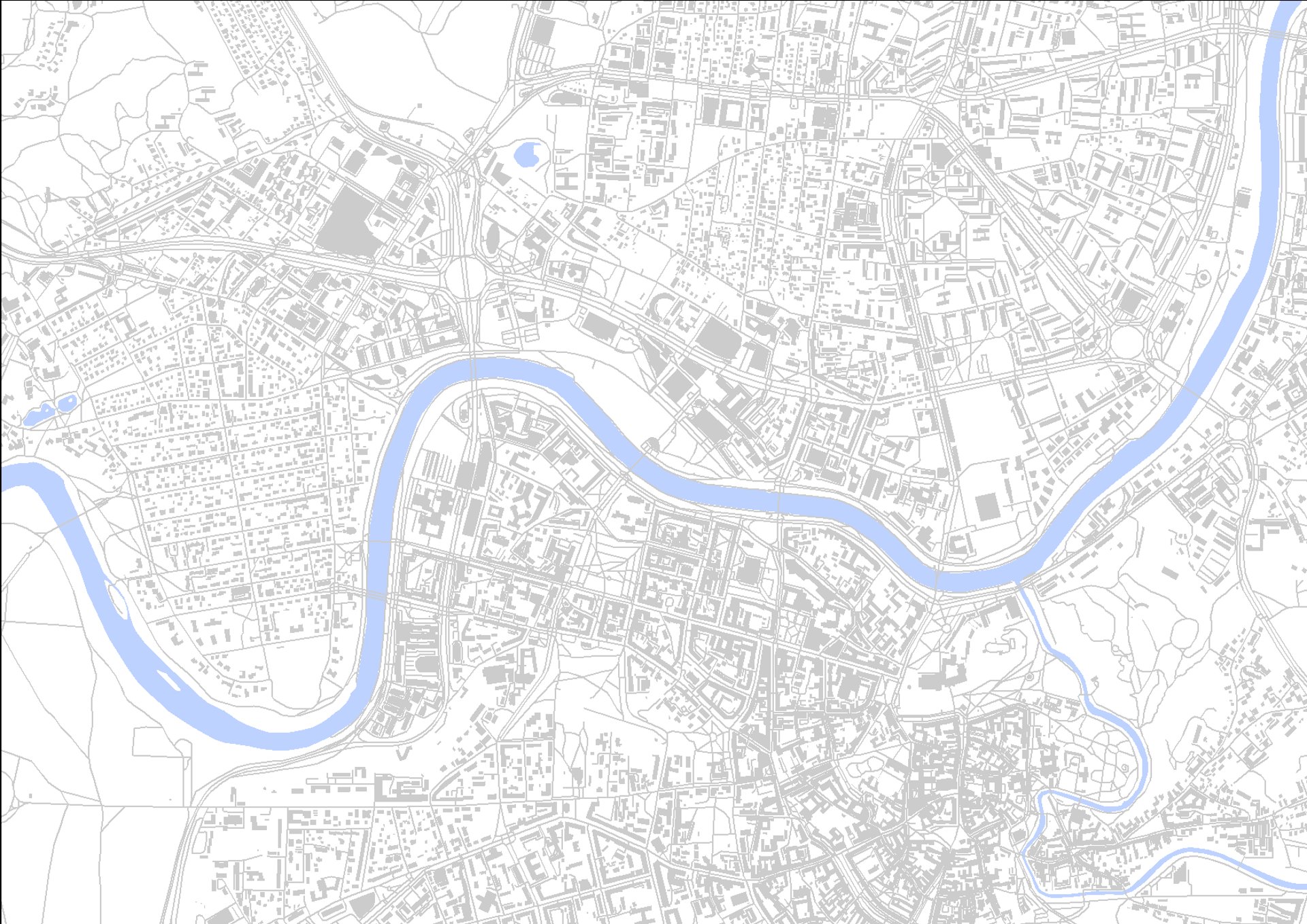
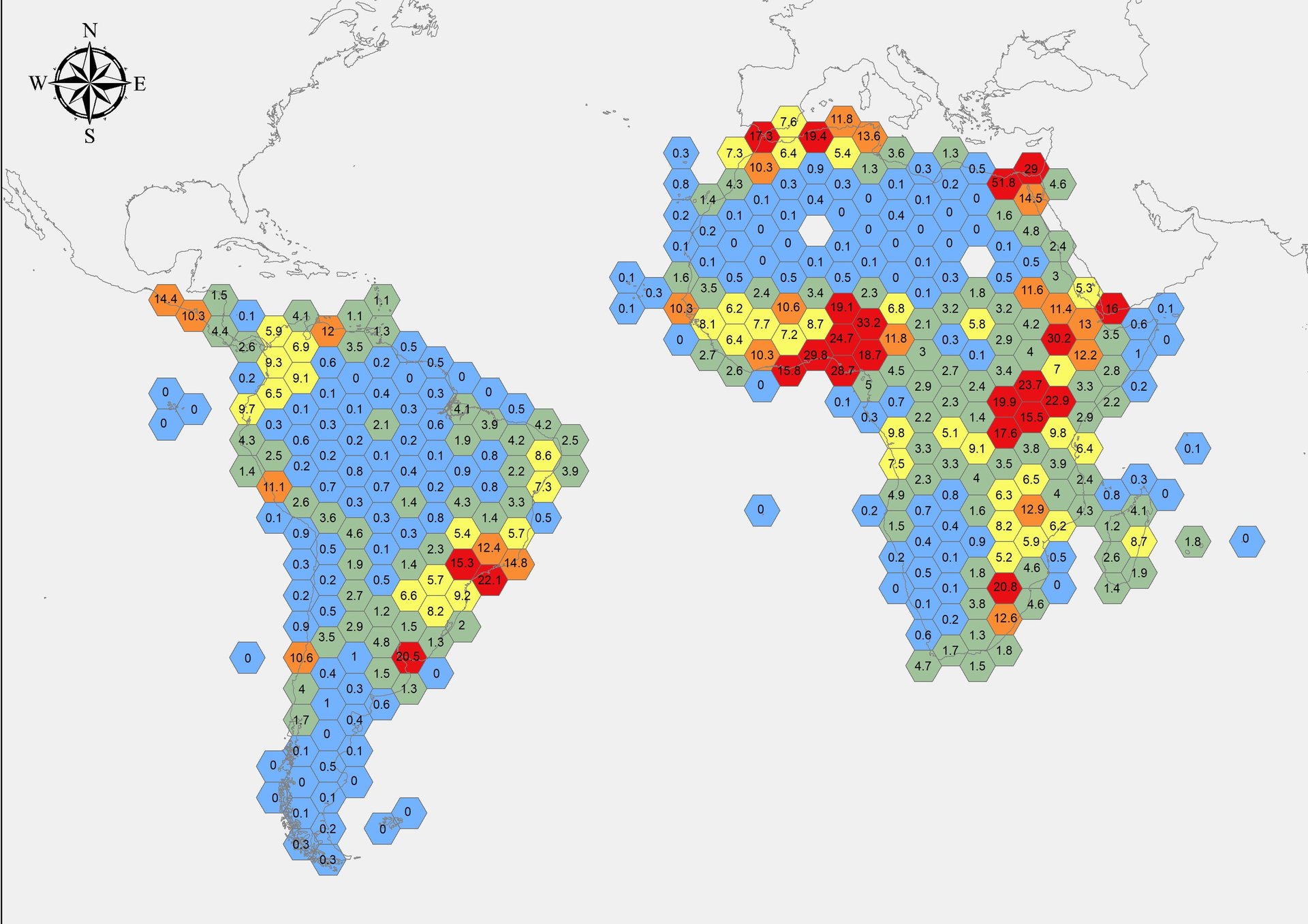
Map visualizations, GIS & Dashboards

Welcome to my corner of the digital world! As a freelancer, I specialize in Geographic Information Systems (GIS), utilizing tools like ArcGIS and QGIS for spatial analysis and mapping solutions. My expertise is dedicated to helping you visualize, analyze, and interpret spatial data effectively, leveraging the power of GIS technology.

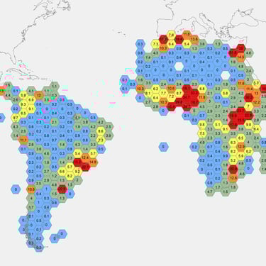
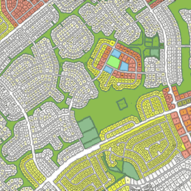
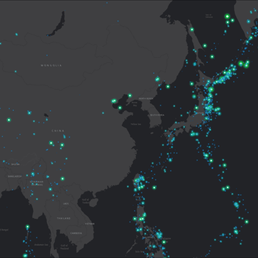
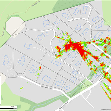
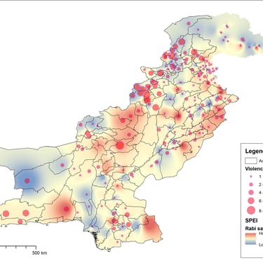
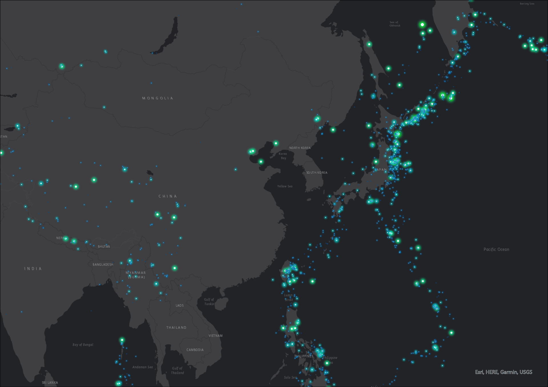
Data visualization and analysis are at the heart of what I do. Through digital mapping and advanced GIS techniques, I empower businesses, organizations, and individuals to make informed decisions and solve complex problems. By harnessing geospatial data and integrating various sources such as maps, satellite images, and numerical data, I uncover valuable insights and trends.

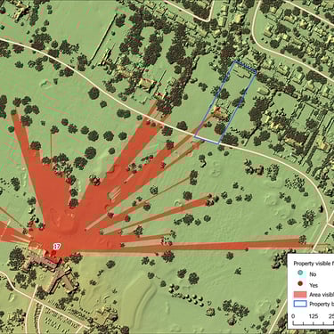
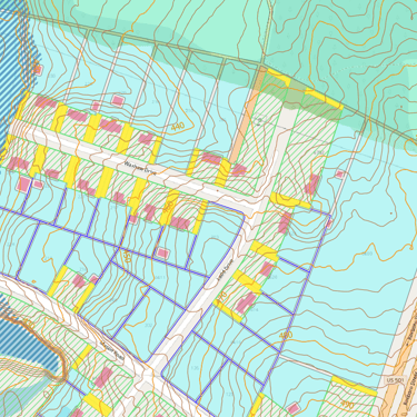
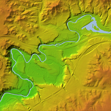
GIS is the backbone of my work. It enables me to capture, store, manipulate, analyze, and visualize spatial data with precision. By leveraging GIS technology, I can understand relationships, patterns, and trends in the real world, ultimately facilitating better decision-making processes.

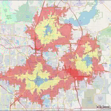
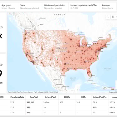
I excel in developing web map applications and interactive dashboards that provide intuitive access to geospatial insights. With proficiency in graphic design, I ensure that the visual representation of data is both informative and visually appealing. Utilizing platforms like ArcGIS Online, I create dynamic maps, dynamic dashboards and deploy applications that enable seamless data sharing and collaboration. Moreover, I'm adept at data mining, enabling the extraction of geospatial data from various sources for analysis and visualization.

Services and experience
Why Choose Me?

Expertise: I am an experienced GIS professional with a deep understanding of spatial analysis techniques, mapping technologies, and industry best practices.

Customized Solutions: I tailor my services to address your specific requirements, ensuring that my solutions align with your goals and objectives.

Cutting-Edge Technology: Leveraging the latest GIS software, tools, and techniques, I deliver innovative solutions that drive actionable insights and tangible results.

Collaborative Approach: I collaborate closely with my clients throughout the project lifecycle, ensuring transparency, communication, and satisfaction.

Value for Money: I offer competitive pricing and cost-effective solutions that deliver maximum value for your investment in GIS technology.

Flood risk assessment
Spatial data analysis and GIS
map visualization
map visualization
Flood Risk Assessment
Spatial Data Analysis (Vector and Raster)
Data Visualization

I specialize in drafting Flood Risk Assessment Reports for BREEAM certification. The aim of these reports is to evaluate all threats to a construction project and propose recommendations for mitigating flood risk. This process involves analyzing the area's topography, relief, potential sources of flooding such as water bodies and surface runoff, as well as groundwater levels. Throughout the assessment, I scrutinize all potential causes of flooding and evaluate their potential impact on people, property, and the environment.

To date, I have successfully prepared over 50 Flood Risk Assessment Reports for BREEAM certification, serving a diverse range of clients in Lithuania. Some notable clients include Vesta Consulting, Inservis, Eika, Mepco, Avia Solutions Group, Asgaard Property, and LIVE SQUARE LT.

I have executed more than 200 GIS projects on the Upwork freelancing platform. These projects span from simple proximity analysis to complex geospatial modeling. This involves analyzing data represented by points, lines, and polygons to assess the spatial relationship between different features and investigate the characteristics of spatial features to uncover patterns, trends, and anomalies. Through these analyses, I provide clients with valuable insights and actionable recommendations tailored to their specific needs and objectives.

My toolkit includes ArcGIS Pro, ArcMap, ESRI Business Analyst, ArcGIS Online, QGIS, and Carto software. I've conducted spatial data analysis related to Nature Protection, Biodiversity & Ecosystem Services, Real Estate & Urban Planning, Solar Energy, Telecommunications, Targeted Marketing, Geology/Mining, and International Aid for Developing Countries.

With a wealth of experience, I specialize in crafting custom maps that precisely meet the unique requirements of my clients. Having developed hundreds of maps for a global clientele, I've covered a diverse array of topics, including demographic trends, real estate development, infrastructure, earthquakes, service areas, accessibility, ship movement, biodiversity and ecosystem services, and forest pest distribution.

My expertise lies in creating visually compelling maps and visualizations that seamlessly blend aesthetic appeal with clear communication of complex spatial data. By leveraging my artistic eye and attention to detail, I ensure that each map is not only visually engaging but also easy to interpret, facilitating better decision-making and communication of key insights. Whether it's illustrating geographical patterns or conveying intricate spatial relationships, I excel in delivering maps that effectively convey information and resonate with audiences across various sectors and industries.

GIS for Real Estate
GIS for real estate
GIS for real estate

GIS plays a pivotal role in the real estate sector, and I've been actively involved in projects with development companies in the USA, Australia, and New Zealand. My tasks have included vacant parcel assessment, parcel frontage and backyard delineation, zoning analysis for development limitations, elevation contour extraction, surface runoff analysis, vectorization of networks, proximity analysis, ADU fit analysis, geocoding, creating map books with multiple pages and many more. Leveraging GIS automation tools, I can analyze vast amounts of property data to swiftly provide data-driven insights.

Point Cloud & Lidar
point cloud and Lidar analysis

Leveraging Lidar data, I can extract valuable information for various purposes. Lidar data aids in tasks such as elevation contour extraction, volume estimate, cut and fill analysis. I frequently utilize high-resolution digital elevation models for flood risk assessment. Additionally, I possess expertise in Lidar data classification, filtering, and processing. This data source has enabled me to pinpoint the location of electricity poles, extract building footprints, analyze vegetation for signal penetration, and optimize the placement of 5G transmitters. Lidar point cloud data also serves as an excellent resource for visibility and viewshed analysis.

WebGIS & Dynamic Dashboards

I specialize in developing WebGIS maps and creating map-centered dynamic dashboards using platforms like ArcGIS Online and Carto. I've developed several dozen dynamic web maps for Upwork clients, covering topics ranging from ticket sales and solar roof suitability to ship movement and visualization of aid projects in Africa.

The map-centered dynamic dashboards enhance interactivity by allowing users to filter data by attribute values or map selection. They also facilitate instant updates of indicators, tables, or gauges, making them perfect for slicing map-based data.

ArcGSI online dashboard
Portfolio

Contact Me

Discuss geospatial analysis and mapping needs together

Simonas Valatka
Simonas Valatka

Follow me