Interactive land value web map with filters
10/21/20241 min read
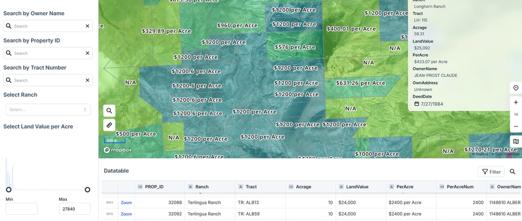
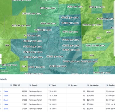
I developed an interactive land value map for a client in Texas, enabling users to efficiently search for parcels by owner name, property ID, tract number, or land value per acre. This GIS-driven solution incorporates advanced digital mapping and spatial analysis to visualize land values across various regions. By integrating a user-friendly interface with geolocation capabilities, the map provides dynamic filtering and seamless access to key property data. This project showcases my expertise in data visualization, geospatial data processing, and building practical tools for real estate analysis and decision-making.