Real estate parcel analysis, Los Angeles County, California
9/9/20241 min read
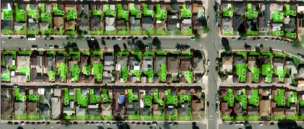
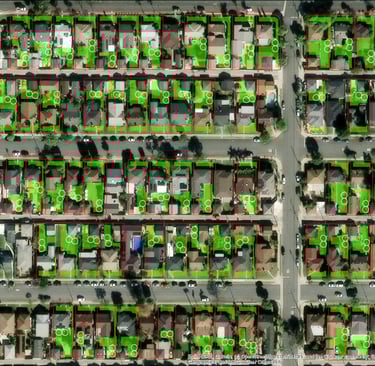
For this project, I developed a custom GIS model to identify residential parcels in Los Angeles County, CA with sufficient open space to accommodate two adjacent 14-foot diameter circles. Using geospatial analysis, I extracted and analyzed open spaces for all residential properties, automating the process to ensure efficiency and accuracy. The results were presented through digital maps and data visualizations, offering a clear and interactive view of the qualifying parcels. This solution provides a powerful tool for urban planning and development, making it easy for the client to identify suitable locations across the county.